
MTB Cycling in Donovaly for Mountain and Trekking Bikes.
The application is not further supported. Contents moved to MTB cycling route Slovakia.
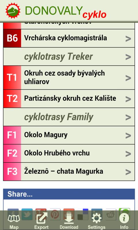
MTB cycling on Donovaly for those who like to admire the beauty of nature from the bike saddle. Donovaly offer many marked cycling routes for mountain and trekking bikes, as well as opportunities for families with children.
Website: http://cyklowebka.sk
Rastry DESCRIPTION + GPS
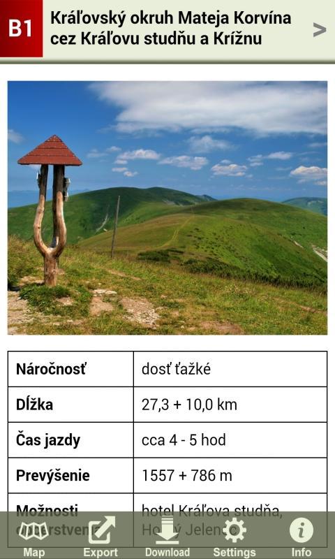
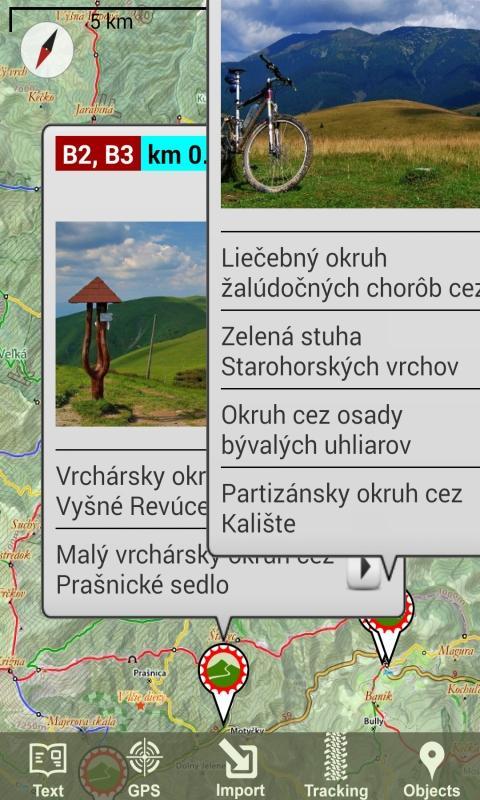
The description of each route contains text, photos, GPS trackpoints and so -called. Points of interest (refreshments ...). GPS Trackpoints and points of interest are displayed on the map, respectively. They can be exported and used in another application or other GPS devices.
Maps
The application creates a download of its own offline map. In addition, there are several other maps online and offline. All maps can be zoomed even more than the native zoom. The following maps to choose from:
- Topographic maps SK with tourist brands and forest roads NLC
- worldwide popular Google Maps
- Offline maps, delivered to the SQLite user (Mbtiles, Osmand, RMAPS)
Navigation
The following features can be used for navigation:
- View the route
- View your own position
- Compass view
Tracking
This feature records the route passed. In addition to GPS coordinates, the record also includes information about time and altitude. It is possible to add your own points on the route (so -called Waypoints), which may also include photos from the gallery.
Cyclocomputer
The following features can be used in Tracking mode:
- Record of the route
- Showing an altitude
- View the distance traveled
- Showing the height meters of
Objects
The application downloads different types of objects that are interesting for the cyclist (accommodation and restaurant facilities, water springs, cultural and historical buildings ...). Depending on the option, objects appear in the map.
 Download