• halaman depan
  • permainan
    petualangan aksi Bisnis simulasi permainan peran Kompetisi olahraga Teka-teki kasual strategi kartu ritme musik Teka-teki kata penembakan penerbangan perkembangan cinta
  • aplikasi
    kantor bisnis Komunikasi dan sosial Gaya Hidup dan Hiburan belanja daring Alat utilitas perjalanan perjalanan manajemen keuangan pembelajaran pendidikan Pembacaan informasi Olahraga dan kesehatan
  • artikel

English 中文(简体) 中文(繁体) 한국어 日本語 Português Español Русский العربية Indonesia Deutsch Français ภาษาไทย
halaman depan aplikasi perjalanan perjalanan Ships and Vessels
Ships and Vessels

Ships and Vessels

1
2
3
4
5
unduh
  • Versi 2.1
  • kategori perjalanan perjalanan
  • nama paket com.ous.trackaship
  • Perbarui waktu October 30, 2024
  • ukuran 50MB
Tentang aplikasi ini

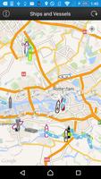
Find Ships and Vessels in your area or worldwide.

This app presents allows users to locate Ships and Vessels live on a map.

Just open the app, let it find your location and press the refresh button.

Jika ada kapal di dekatnya dengan transponder AIS yang sesuai dan stasiun penerima di jaringan kami mengambilnya, Anda harus dapat melihat kapal di peta.

See the following ship/vessel details:

Perbarui waktu

MMSI number

IMO number (Internation Maritime Organisation)

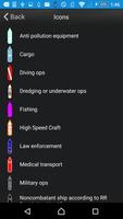
Ship Type (Passenger, cargo, pleasure, dive, military and many more)

Navigational status (under way, berthing, moored and many more)

Rate of Turn (when available)

Speed (kts)

Kursus

True Heading

Special Maneuvres

Latitude and Longitude

Destination port (call of port) when available

ETA (Estimated Time of Arrival) when available

Vessel Length (meters)

Vessel Width (meters)

Vessel Draught (meters)

To Bow (from AIS transponder)

To Stern (from AIS transponder)

To Port (from AIS transponder)

To Starboard (from AIS transponder)

We hope you enjoy the app please leave a good rating in order to keep us improving the app.

Apa yang baru di versi terbaru 2.1

Last updated on Sep 27, 2015 This new version introduces ship search functionality based on ship names. Furthermore, it lets the user see the ship details based on the information received from the AIS signals that the ship transmits.
Ships found that have data older than 30 minutes will be shown as a red crosshair.
Furthermore, it fixes a minor problem with search functions found in earlier versions.
unduh(50MB)
Pengguna juga melihat
  • taxiplon Driver

    taxiplon Driver

    2.8.3.14 July 8, 2025
  • Earth Map: Live Satellite View

    Earth Map: Live Satellite View

    1.0.09 July 8, 2025
  • Club Ride Rewards

    Club Ride Rewards

    3.3.4 July 8, 2025
  • SmartTraveler

    SmartTraveler

    01.05.04 July 7, 2025
  • DDOT Bus App

    DDOT Bus App

    3.0 July 7, 2025
  • Pozor RADAR!!!

    Pozor RADAR!!!

    1.2 July 7, 2025
  • EasyGaadi

    EasyGaadi

    2.2 July 7, 2025
  • OCR Travel

    OCR Travel

    3.3.1-beta July 7, 2025
  • Ruedataxi taxista

    Ruedataxi taxista

    1.1.9 July 7, 2025
  • Jaltest Telematics Mobile

    Jaltest Telematics Mobile

    22.1.11 July 7, 2025
  • The Art of Motorcycle Maintenance

    The Art of Motorcycle Maintenance

    10.3 July 7, 2025
  • MyJTA

    MyJTA

    5.150.1.1647 July 6, 2025
  • Local Guide

    Local Guide

    1.1 July 6, 2025
  • ABE (GPS communautaire)

    ABE (GPS communautaire)

    1.0.1 July 6, 2025
  • Auto VIN Decode Pro

    Auto VIN Decode Pro

    1.6 July 6, 2025
About Privacy Policy Terms of Service Cooking Policy

© Copyright 2017-2025 downzs.com