

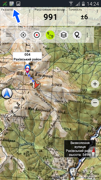
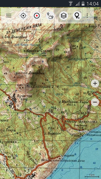
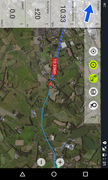
World-wide topographic maps.
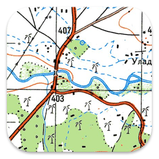
Offroad Navigation App with worldwide topographic maps (mainly Russian General Staff). For many countries in Africa and Asia these maps still belong to the best available topomaps.
Available map layers:
• Topomaps worldwide (worldwide seamless coverage, mainly 1:100.000)
• ROSREESTR The Federal Service for State Registration, Cadastre and Cartography
• Google Maps (Satellite images, Road- and Terrain-Map)
• Open Street Maps (OSM Mapnik, Osmarender and Cloudemade Cyclemap)
• Bing Maps
• ESRI Maps
This app gives you similar mapping options as you might know from Garmin or Magellan GPS handhelds.
Main features for Outdoor-Navigation:
• Create and edit Waypoints
• GoTo-Waypoint-Navigation
• Track Recording (with speed and elevation profile)
• Tripmaster with fields for odometer, average speed, bearing, elevation, etc.
• GPX,KML - Import
• Search (placenames, POIs, streets)
• Customizable datafields in Map View and Tripmaster (e.g. Speed, Distance, Compass, ...)
• Bulk-download of map tiles for OFFLINE USAGE (NOT in free version)
• Импорт Oziexplorer map format in OZF2 OZFX3 extension (NOT in free version)
• Импорт OpenStreetMaps in vector format (NOT in free version)
• Waypoint-/Track-Sharing (via eMail, Facebook, ..)
• and many more ...
Soviet Military Maps is the perfect moving map app for offroad trips, adventure travels and expeditions. You are planning cross country trips to Sahara desert or a trekking tour to the Himalayas ? With the Russian topos you have always a great alternative to other map sources. Beneath the good topography the maps include many small trails and unpaved roads that are missing in other map sets.
The Russian maps have additional English labels.
Attention: The Soviet Military Maps were created mainly in the 80ies and are less interesting for industrialized countries. Outside Africa and Asia you'll find the OSM / Google map layers more useful.
Please note: This app does not provide direct "Turn-by-Turn" navigation - but with a selected waypoint you can easily switch to Google Navigation.
LIMITATIONS OF THE FREE VERSION:
• Ads
• Max. 3 Waypoints
• Max. 3 Tracks
• No import of waypoints and tracks
• No Bulkdownload
• No Local City DB (Offline Search)
• No Hillshading Overlay
Please contact us if you have any questions, feature requests or bug reports regarding this app: [email protected]
Map coverage:
Scale 1:100.000 and 1:200.000 :
Europe, Afghanistan, Azerbaijan, Georgia, Japan, Jordan, Latvia, Lithuania, Kazakhstan, Kyrgyzstan, Morocco, Mongolia, Pakistan, Russia, Syria, Tajikistan, Turkey, Turkmenistan, Ukraine, Uzbekistan, Belarus
Scale 1:200.000 :
Afghanistan, Egypt, Algeria, Angola, Argentina, Armenia, Azerbaijan, Bahrain, Bangladesh, Belarus, Benin, Bhutan, Bolivia, Botswana, British Virgin Islands, Bulgaria, Burkina Faso, Burma, Cambodia, Cameroon, Central African Republic, Chad, Chile, China, Comoros, Ivory Coast, Cuba, Cyprus, Czech Republic, DR Congo (part), Djibouti, Eritrea, Estonia, Ethiopia, Falkland Islands, Finland, Gambia, Georgia, Ghana, Guinea, Guinea-Bissau, Iceland, India, Indonesia, Iran, Iraq, Israel, Jamaica, Jordan, Kazakhstan, Kenya (part), Kuwait, Kyrgyzstan, Laos, Latvia, Lebanon, Lesotho, Liberia, Libya, Lithuania, Madagascar, Malawi, Malaysia, Mali, Mauritania, Moldova, Mongolia , Morocco, Mozambique, Namibia, Nepal, Niger, Nigeria, North Korea, Oman, Pakistan, Philippines, Qatar, Romania, Russia, Saudi Arabia, Senegal, Sierra Leone, Singapore, Slovakia, Somalia, South Africa, South Korea, Spain, Sri Lanka , Sudan, Svalbard, Swaziland, Sweden, Syria, Taiwan, Tajikistan, Tanzania (part), Thailand, The Gambia, Togo, Tunisia, Turkey, Turkmenistan, Ukraine, United Arab Emirates, Uzbekistan, Vietnam, Western Sahara, Yemen, Zambia, Zimbabwe
Scale 1:250.000 (Local maps from USGS, Geoscience Australia, CTIO ):
USA, Canada, Australia
Scale 1:500.000:
All other countries










 Download